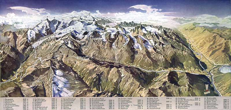
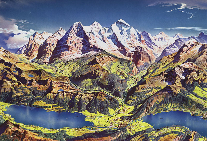
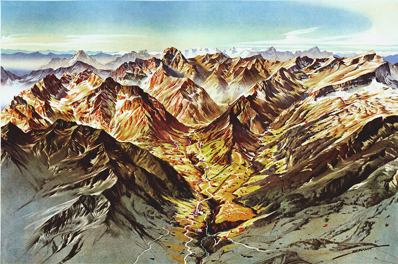
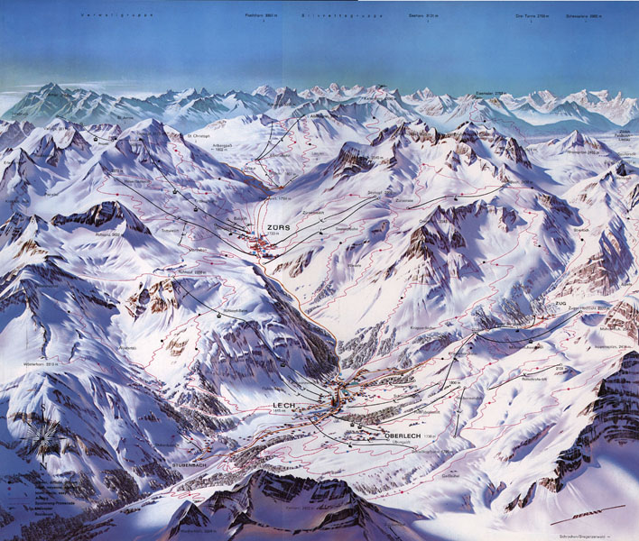
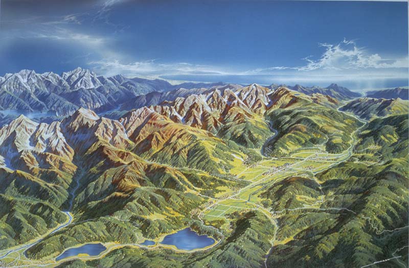
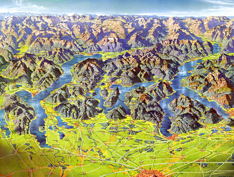
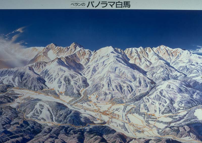
H.C. Berann's cartographic career started in 1934 with his first map on the occasion of the opening of the "Grossglockner Hochalpenstrasse" mountain pass road in Austria (shown above). The next milestone was his first panoramic map done abroad in 1937 for the famous "Jungfraubahn" mountain railroad in Switzerland (a later version shown above). Hundreds of maps followed in the decades after the second world war, including the selection of older and recent maps shown below:
|
|
|
|
His fame as painter of panorama maps spread rapidly and brought him contracts to paint maps for several olympic games:
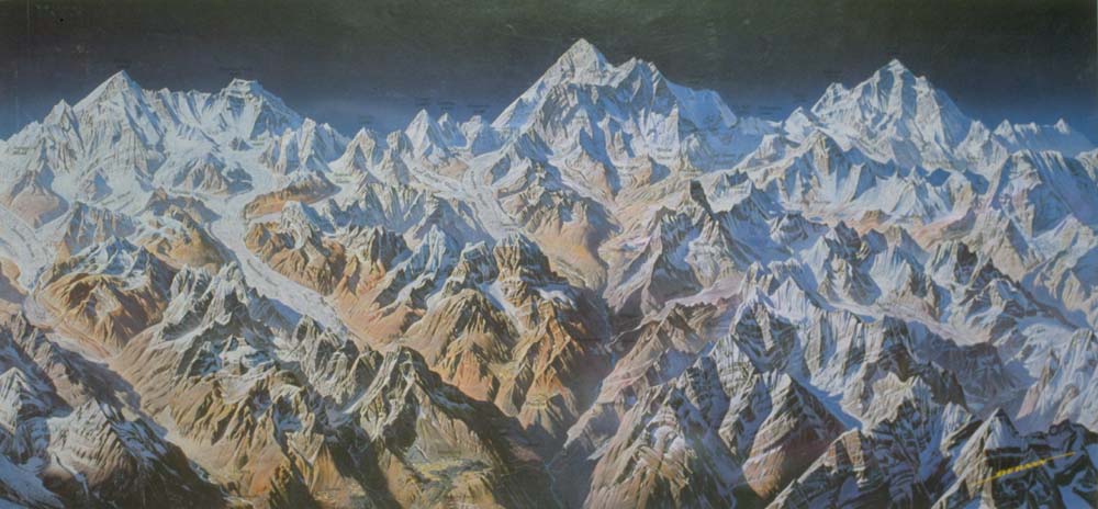
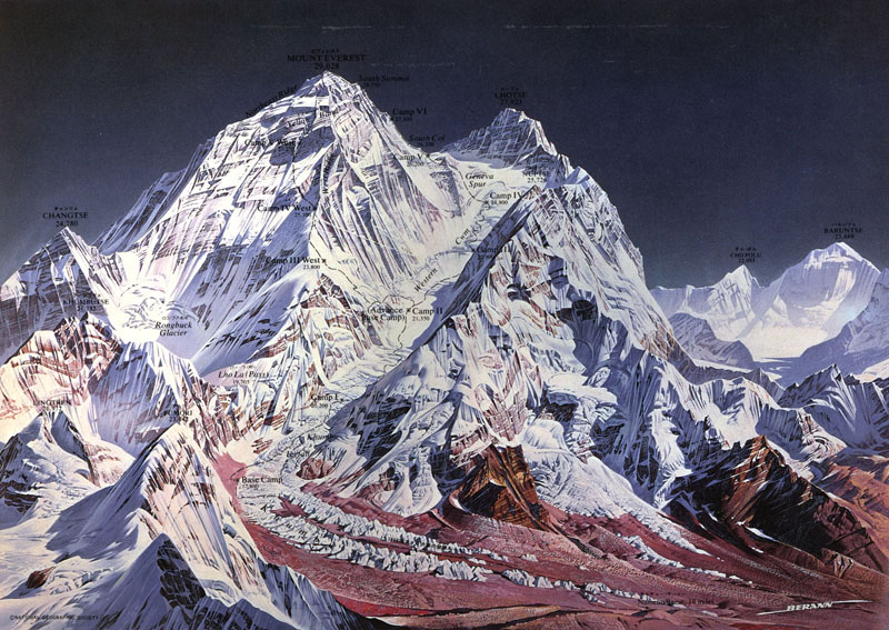
It did not take long and his fame spread overseas, where the National
Geographic Society became aware of his talent and asked him to paint two
Himalayan maps in 1963: an overview of Khumbu Himal
and a map of Mt. Everest (both shown above).
A fruitful collaboration over many years followed.
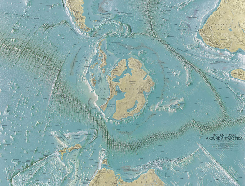
The collaboration with the national Geographic Society also lead to maps
of the ocean floors starting in 1966. In co-operation with the pioneer of
oceanography Prof. Bruce Heezen of the Columbia University, NY, and his
assistant Mary Tharp maps of all the ocean floors were created. This co-operation
culminated in the famous World Ocean Floor map done in 1977 for the Columbia
University and the U.S. Navy.
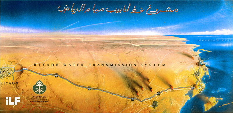
Other overseas contracts were quick to follow, including:

In the last decade of his professional work he painted, besides uncountable maps of tourist resorts, also a few large area maps, including:
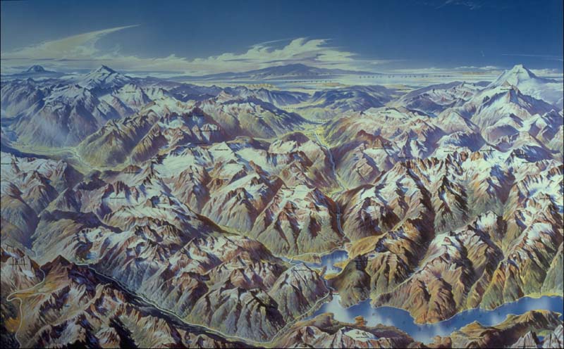
Cascades National Park |
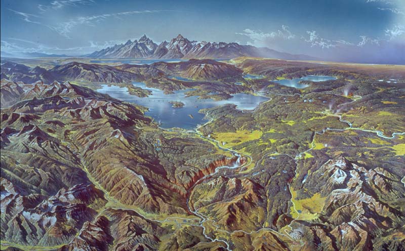
Yellowstone National Park |
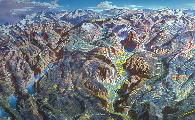
Yosemite National Park |
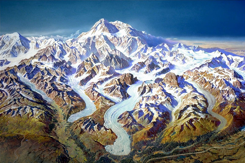
Denali National Park |
The works for hire
Prints for sale |
|
The art
Reprints for sale |